
Atlas Field Habitats
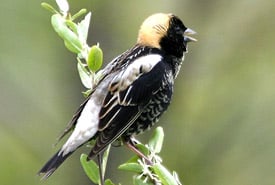
Bobolink (Photo by Bill Hubick)
Context
In Quebec, field habitats (cultivated fields, grasslands, pastures and wild lands) have undergone major transformations since the 1950s. Traditional farms combining crop and livestock production have gradually given way to more intensive, large-scale cereal farms. At the same time, natural grassland environments, which essentially occupy the edges of wetlands and run along floodplain banks, have also undergone various alterations. These factors, combined with others such as the loss of agricultural land to other uses, have led to a marked decline in wildlife species using open environments. This decline in populations has been particularly marked in field birds over the last 50 years. Faced with this situation, various organizations have been implementing conservation measures since the early 2000s, most of them in close collaboration with agricultural producers. Initiatives have been undertaken in several regions of southern Quebec, including Montérégie, Outaouais, Estrie and Centre-du-Québec.
Until now, despite the scale of action taken in certain regions, there was no large-scale planning tool integrating the whole of Quebec's agricultural area. This Atlas of Field Habitats of Conservation Interest in Southern Quebec, produced by the Nature Conservancy of Canada (NCC), fills this gap. It presents the sites where conservation needs are greatest for two distinct types of environments: agricultural grasslands (perennial crops) and fallow lands.
This atlas is intended to support the development of conservation strategies (protection, restoration and sustainable use) by the various stakeholders present in the area. In this respect, NCC favours a collaborative approach with agricultural producers. It, therefore, invites interested individuals and organizations to work with stakeholders in the agricultural community, such as agronomists, advisory clubs and the regional offices of the Union des producteurs agricoles du Québec.
Interactive map (in French only)
To view the map in full screen, click here.
Using the map
The interactive map’s basic display shows the results of the selection and prioritization analysis for the two types of environment evaluated: agricultural grasslands and fallow lands. This display shows a conservation threshold of 30 per cent for each of the environments, meaning that only the 30 per cent of field environments of greatest conservation interest are displayed. This threshold is based on the objectives of the Kunming-Montreal Global Biodiversity Framework.
Click on the Layers icon in the toolbar on the left of the map to view the atlas’s data according to one or other of these environments, or both together.
Users can also choose a specific conservation threshold (%) by first clicking the Custom Objective layer, then the Filter tool. The basic filter is set to 100 per cent, which allows users to look at all field environments included in the analysis.
Methodology
The sites of conservation interest for each of the natural habitats were determined on the basis of selection and prioritization analyses, using a series of criteria validated by an expert committee. Find out more about the methodology used in a document containing the analysis’ details here: Rapport méthodologique (in French only)
Support
The interactive map and the database displayed here and the database published on the Données Québec portal are flexible tools that can meet the needs of multiple stakeholders in the field of conservation and agriculture. Using these tools can present certain challenges, however. That’s why NCC offers support that addresses the following aspects, depending on the user's needs:
- analyses and criteria used;
- databases and their attribute tables;
- interactive map functions; and
- potential uses for the atlas.
For support, please contact Pascal Côté, head of the atlas project at NCC, at pascal.cote@natureconservancy.ca.
Major partner of the atlas
NCC would like to thank the Quebec government for its financial support in the creation of this Atlas of Field Habitats of Conservation Interest in Southern Quebec, through the Accélérer la conservation dans le sud du Québec project.
About us
The Accélérer la conservation dans le sud du Québec (ACSQ) project is a co-funding agreement between the gouvernement du Québec and the Nature Conservancy of Canada (NCC), benefiting Quebec conservation organizations. The project aims to protect and conserve natural habitats of ecological interest, notably through the acquisition of private land, for protected and conserved areas and the establishment of ecological corridors. Through this, the ACSQ will promote the development and sound management of the network of protected areas on private land, as well as public access to nature. The gouvernement du Québec invested $144 million in the ACSQ over five years; this must be matched by NCC and its partners with other funds not provided by the gouvernement du Québec.
Resources
Access the atlas database here (in French only).
The Atlas of Field Habitats of Conservation Interest in Southern Quebec project was developed as part of a process led by Benoît Jobin, biologist, Environment and Climate Change Canada's Canadian Wildlife Service, to draw up an action plan for the conservation of field birds in Quebec. The plan was published in winter 2025 and can be accessed here (in French only).
The appropriate quote for this web page is as follows:
Nature Conservancy of Canada. 2025. Atlas of Field Habitats of Conservation Interest in Southern Quebec – Interactive Map.